
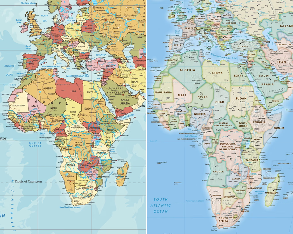

The United Nations General Assembly has voted to formally move away from the centuries-old Mercator map projection, adopting instead a resolution that endorses the more geographically accurate Equal Earth design introduced in 2018.
The vote, held at UN headquarters in New York, passed with 164 countries in favour. The United States was the sole country to vote against it, with its delegate describing the resolution as unnecessary, while six nations abstained.
Although UN resolutions carry no binding force meaning no country or institution is required to drop the Mercator map or barred from continuing to use it,the decision is expected to influence how the map is used in schools, technology platforms and government bodies, given how deeply embedded the Mercator projection has become across those areas.
The push for the change was led by Togo on behalf of the African Union. In its framing of the resolution, Togo argued that distorted map projections, the Mercator chief among them, have shaped how people perceive the size of Africa and other regions for generations, with lasting effects on education, culture and geopolitics. Togo’s foreign affairs minister, Robert Dussey, told delegates ahead of the vote that the case for change rested on scientific evidence rather than politics.
Created by Flemish cartographer Gerardus Mercator in 1569 as a navigational aid for sailors, the projection has endured as the default world map for nearly 500 years. Its design distorts landmasses depending on how close they sit to the equator: regions nearer the equator are rendered smaller than they really are, while areas at higher latitudes are exaggerated. The effect is stark when comparing Africa and Greenland, which appear similar in size on a Mercator map despite Africa being roughly 14 times larger.
That distortion has fuelled the #CorrectTheMap campaign, a Change.org petition with more than 11,000 signatures, which notes that Africa’s actual landmass is large enough to contain the United States, China, India, Japan, Mexico and much of Europe combined, with room left over. The African Union backed the campaign in August 2025 before asking Togo to carry the resolution forward at the UN.
France also voiced support ahead of the vote. Foreign minister Jean-Noël Barrot announced the country would drop the Mercator projection in favour of the Eckert IV projection a design similar to the Equal Earth model recommended in the resolution — in what was widely read as part of a broader French effort to rebuild goodwill with its former colonies.
Scholars and campaigners have long argued that the Mercator map reflects a Western-centric worldview, with some describing its influence as a form of “cartographic colonialism.” Critics say the map has done more than distort geography by shrinking the visual footprint of equatorial nations and enlarging those in the northern hemisphere, it is thought to have reinforced global imbalances in trade, development priorities and education. German historian Arno Peters was among the most vocal critics, launching the Gall-Peters projection in 1973 as an alternative that has periodically been used in place of the Mercator map since.
Geopolitical analyst JJ Enoch of JS Held, a London-based advisory firm, linked the campaign to a broader push by African nations for greater influence within global institutions and more say over how the continent is portrayed internationally. He said adopting an equal-area map would give education and public understanding a more accurate foundation while signalling that Africa’s demographic, economic and geopolitical weight should no longer be filtered through outdated conventions.
Togo’s government is now planning an event in its capital, Lomé, early next year with Unesco, the African Union and technology companies including Google Maps to work out how the resolution will be implemented in practice. Dussey closed his remarks before the vote by framing the moment as an opportunity for Africa to reshape its own narrative and take charge of the change itself.